Forest management is facing increasing challenges as climate change, complex terrain, and expanding human activities raise the risks of wildfire incidents. Traditional patrol methods often struggle with limited coverage, delayed information, and difficulties in accessing dangerous areas. As a result, a modern forest surveillance and monitoring system is becoming increasingly important for improving early detection, situational awareness, and emergency decision-making.
With advancements in drone technology, artificial intelligence, and 3D spatial intelligence, forest monitoring is evolving from simple observation into a comprehensive digital ecosystem. Icecypress Technology provides spatial intelligence solutions that integrate low-altitude data, drone photogrammetry, and intelligent analysis to support forest fire prevention and emergency response.
The Evolution of Forest Surveillance and Monitoring System Architecture
A modern forest surveillance and monitoring system requires more than cameras or isolated monitoring devices. Large forest areas involve complicated landscapes, unpredictable weather conditions, and rapidly changing emergency situations. Effective management requires continuous data collection, real-time processing, and accurate visualization.
The core architecture usually combines three major capabilities: data acquisition, communication networks, and intelligent applications. Together, these elements allow operators to understand forest conditions, identify potential risks, and coordinate emergency resources faster.
Unlike conventional monitoring approaches that depend heavily on manual inspection, AI-powered systems can process aerial information and transform raw data into actionable intelligence. This shift helps organizations move from reactive firefighting toward proactive risk prevention.
Building a Forest Fire Monitoring System with Integrated Technologies
A reliable forest fire monitoring system must provide early warning while supporting rapid emergency response. Icecypress Technology’s forest fire detection and emergency rescue solution focuses on AI-powered wildfire detection, drone swarm collaboration, real-time situational awareness, and precision search and rescue.
The system architecture developed by Icecypress Technology includes three integrated layers. The infrastructure layer contains portable ground equipment, an intelligent UAV management platform, and integrated communication equipment. These components create the foundation for flexible deployment in remote forest environments.
The second layer focuses on data transmission. Ground and onboard communication networks maintain continuous connectivity between drones, equipment, and command platforms. This helps maintain the delivery of critical information when operating in challenging locations.
The application layer provides advanced functions, including communication management, surveying and visualization, cooperative UAV swarm task planning, onboard processing, and ground station software. This integrated structure supports workflows from initial fire detection to coordinated emergency action.
Drone Swarm Collaboration Improves Forest Emergency Response
Large-scale forests present significant challenges for traditional inspection methods. A single drone or ground team may require substantial time to cover wide areas, especially when terrain is steep or inaccessible. Drone swarm technology offers a more efficient approach by allowing multiple UAVs to perform coordinated missions.
Icecypress Technology’s DroneSwarm technology combines onboard AI processing with multi-drone collaboration to create an intelligent aerial operation system. The solution supports real-time reconstruction, precise positioning, and rapid information processing without relying entirely on remote computing facilities.
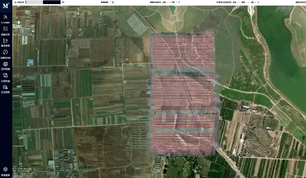
For forest firefighting scenarios, drone swarms can quickly collect aerial imagery, generate two-dimensional and three-dimensional models, and provide visual references for rescue teams. This capability helps emergency personnel understand fire locations, terrain conditions, and possible evacuation routes before entering hazardous areas.
3D Modeling and AI Create Real-Time Situational Awareness
One of the key advantages of modern forest monitoring solutions is the ability to transform aerial data into a digital representation of the environment. Instead of receiving fragmented images, operators can access comprehensive spatial information through 3D models and intelligent analysis.
Icecypress Technology applies its expertise in spatial intelligence, combining drone photogrammetry with 3D reconstruction and AI algorithms. Its technology pipeline captures aerial data, reconstructs detailed spatial models, and analyzes information to support decision-making.
In emergency scenarios, real-time modeling allows rescue teams to evaluate changing conditions more effectively. AI-based recognition technologies can also assist with identifying targets, tracking environmental changes, and improving response accuracy.
Future Development of Intelligent Forest Fire Prevention
As forest management becomes more data-driven, the demand for intelligent monitoring platforms will continue to grow. Future systems will not only detect fires but also combine environmental information, historical data, and predictive analysis to improve prevention strategies.
A complete forest fire monitoring system should support the entire lifecycle of forest protection, including risk assessment, early warning, emergency response, and post-event analysis. Integrated solutions based on drones, AI, and spatial intelligence can support more efficient and safer emergency operations.
Icecypress Technology’s approach reflects this trend by creating geospatial intelligence solutions that connect low-altitude data with practical industry applications. Through independent core technologies and AI-powered platforms, the company supports smarter operations across emergency response and other industries.
Advancing Forest Protection Through Spatial Intelligence
The development of intelligent forest management requires technologies that can bridge the gap between physical environments and digital decision-making. Traditional monitoring methods alone cannot fully address the challenges of modern wildfire prevention.
By combining drone swarm collaboration, AI analysis, real-time modeling, and integrated system architecture, Icecypress Technology demonstrates how advanced spatial intelligence can improve forest safety. Its forest fire detection and emergency rescue solutions provide organizations with a more complete approach to monitoring, response, and protection.
As forests become increasingly important ecological resources, advanced forest surveillance and monitoring system solutions will play a vital role in creating safer, faster, and more intelligent emergency management frameworks.
